• Portal UGM
    • Profil UGM
    • Pendaftaran Mahasiswa
    • Simaster
    • Akademik
    • Kemahasiswaan
    • Perpustakaan
    • IT Center
    • LPPM
  • Portal Geografi
    • Faluktas Geografi
    • Geografi Lingkungan
    • Sains Informasi Geografi
    • Geografi Pembangunan
  • Bahasa Indonesia
    • English
    • Bahasa Indonesia
Universitas Gadjah Mada Laboratorium Geomorfologi Lingkungan dan Mitigasi Bencana
Fakultas Geografi, Universitas Gadjah Mada
  • Home
  • Layanan
    • Uji Tanah
    • Penyewaan Alat
    • Praktikum Semester I
    • Praktikum Semester II
  • Pelatihan
    • Geomorfologi Longsor
    • Geomorfologi Gunung Api
    • Geomorfologi Karst
    • Geomorfologi Sumberdaya
    • Geomorfologi Kepesisiran
  • Portofolio
  • Staff
  • FORMULIR
  • Beranda
  • Penelitian
  • Volunteered Geographic Information Mobile Application for Participatory Landslide Inventory Mapping

Volunteered Geographic Information Mobile Application for Participatory Landslide Inventory Mapping

  • Penelitian
  • 30 November 2022, 08.02
  • Oleh: glmb.geo
  • 0

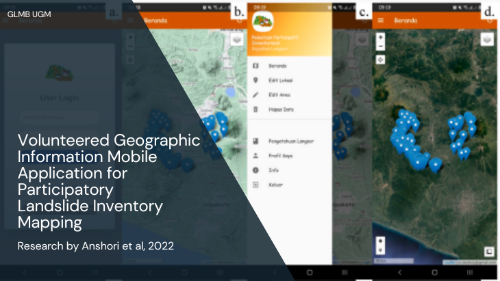
Research by Anshori et al., 2022

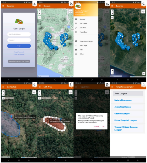
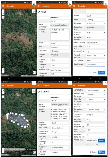
Participatory landslide inventory mapping using the Volunteered Geographic Information (VGI) mobile app is a promising method to produce a landslide inventory map. The aim of this research is to describe the development and implementation of the VGI mobile app for participatory landslide inventory mapping. The architecture VGI mobile app is developed on the basis of Free Open-source Software for Geospatial Application server-client software to ensure reproducibility and flexibility, and to reduce cost. Anyone can reproduce, modify, and share the code, which suggests improvement in the collective ability to use, prepare, and landslide inventory update. Landslide inventory using VGI mobile app shows that the tool and method successfully map landslides in the landslide prone area (Magelang Regency, Central Java Province, Indonesia) with fairly high levels of effectiveness and convenience. Magelang Regency, one of the landslide prone areas in Java, is located in the intermountain basin surrounded by Menoreh Mountain, Merapi, Merbabu, Suropati-Telomoyo Complex, and Sumbing Volcano.

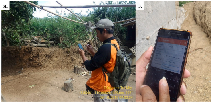
In this study, landslide inventory mapping using VGI mobile app was applied in Magelang Regency by 17 volunteers from BPBD (Regional Agency for Disaster Management) Magelang Regency for three days. Landslides area occurred from 2017 to 2019 were properly identified and mapped by the volunteers. The sizes of landslides varied from 5.2 m2 to 4,632.5 m2 , and the average was 208.2 m2 . A team of volunteer was able to map 7-10 landslides per day. Participatory mapping using VGI mobile app reduces the time in transferring field data to a GIS database, in contrast to conventional participatory landslide inventory mapping. VGI mobile app allows users to provide new geographical landslide data, share landslide data rapidly, ensure consistency of landslide data, and improve accessibility of landslide data. The use of the VGI mobile app for participatory landslide inventory mapping provides new opportunities to improve risk assessment, preparedness, and early action and warning to landslide hazard.

Keywords: Landslides, Inventory, Mobile, Participatory mapping, Volunteered geographic information

User Interface PEPARING

User Interface PEPARING

User Interface PEPARING

User Interface PEPARING

A Volunteer Mapped a Landslide Using the Mobile App

A Volunteer Mapped a Landslide Using the Mobile App

Unduh dan baca selengkapnya

Tags: Inventory Landslides Longsor Participatory mapping Penelitian

Leave A Comment Batalkan balasan

Alamat email Anda tidak akan dipublikasikan. Ruas yang wajib ditandai *

*

Recent Posts

  • Pengumuman Pelaksanaan Praktikum Semester Genap T.A. 2024/2025
  • Prosedur Peminjaman Alat
  • Prosedur Pelayanan Uji Sampel Tanah
  • Daftar Sewa Alat
  • Pengumuman Pelaksanaan Praktikum Manajemen Bencana Semester Gasal T.A. 2023/2024
Universitas Gadjah Mada

Laboratorium Geomorfologi Lingkungan dan Mitigasi Bencana
Gedung Klinik Lingkungan dan Mitigasi Bencana Lantai 1

Fakultas Geografi Universitas Gadjah Mada
Sekip Utara, Bulaksumur, Yogyakarta 55281
Phone (0274)6492337
Email: glmb.geo@ugm.ac.id

© Universitas Gadjah Mada

KEBIJAKAN PRIVASI/PRIVACY POLICY

[EN] We use cookies to help our viewer get the best experience on our website. -- [ID] Kami menggunakan cookie untuk membantu pengunjung kami mendapatkan pengalaman terbaik di situs web kami.I Agree / Saya Setuju